


Oswego Voting District, Sumter County, South Carolina
About
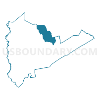
Outline

Summary
| Unique Area Identifier | 666837 |
| Name | Oswego Voting District |
| County | Sumter County |
| State | South Carolina |
| Area (square miles) | 39.01 |
| Land Area (square miles) | 39.00 |
| Water Area (square miles) | 0.01 |
| % of Land Area | 99.97 |
| % of Water Area | 0.03 |
| Latitude of the Internal Point | 34.01762030 |
| Longtitude of the Internal Point | -80.30688320 |
Maps


Graphs
Select a template below for downloading or customizing gragh for Oswego Voting District, Sumter County, South Carolina


Neighbors
Neighoring Voting District (by Name) Neighboring Voting District on the Map
- Ashwood Voting District, Lee County, SC
- Ebenezer #1 Voting District, Sumter County, SC
- Mayesville Voting District, Sumter County, SC
- Mullberry Voting District, Sumter County, SC
- Salterstown Voting District, Sumter County, SC
- St. Charles Voting District, Lee County, SC
- Thomas Sumpter Voting District, Sumter County, SC
- Woodrow Voting District, Lee County, SC
Top 10 Neighboring County Subdivision (by Population) Neighboring County Subdivision on the Map
- Sumter CCD, Sumter County, SC (50,528)
- Sumter North CCD, Sumter County, SC (5,720)
- Ashwood CCD, Lee County, SC (4,001)
- Sumter Northeast CCD, Sumter County, SC (2,818)
- St. Charles CCD, Lee County, SC (1,583)
Top 10 Neighboring Place (by Population) Neighboring Place on the Map
Top 10 Neighboring Unified School District (by Population) Neighboring Unified School District on the Map
- Sumter School District 2, SC (57,252)
- Sumter School District 17, SC (50,204)
- Lee County School District, SC (19,220)
Top 10 Neighboring State Legislative District Lower Chamber (by Population) Neighboring State Legislative District Lower Chamber on the Map
Top 10 Neighboring State Legislative District Upper Chamber (by Population) Neighboring State Legislative District Upper Chamber on the Map
- State Senate District 35, SC (87,583)
- State Senate District 36, SC (84,337)
- State Senate District 29, SC (82,439)
Top 10 Neighboring 111th Congressional District (by Population) Neighboring 111th Congressional District on the Map
Top 10 Neighboring Census Tract (by Population) Neighboring Census Tract on the Map
- Census Tract 4, Sumter County, SC (8,538)
- Census Tract 7, Sumter County, SC (4,604)
- Census Tract 11, Sumter County, SC (4,327)
- Census Tract 9204, Lee County, SC (4,001)
- Census Tract 9205, Lee County, SC (1,583)